Everything around us is in 3D. The world is definitely not flat. Everything is impacted by the third dimension. We live in a 3D world and many spatial questions can only be answered in 3D.
Therefore BitsOfData specializes in the creation and analysis of 3-dimensional data...
3D spatial analysis
With 3D data, topographic mapping contour and elevations are vital parts. The combination of planimetric and topographic mapping to create a depiction of the Earth’s surface features in 3D is invaluable for geospatial analysis and modeling.
3D GIS data can be used for spatial analysis in many different areas, such as 3D city modeling, terrain visualization, industrial design, education, animation entertainment and preservation of historical sites.
The world you perceive is a drastically simplified model of the real world.
We virtualize your world
A raw image is perfect for the human eye to extract all information from, however that is not the case with computer algorithms.
To enable software packages to analyse real-world features, these features need to be transformed into a digital representation. Through 3D modelling and feature extraction the real-world can be represented in a GIS-viewer as a collection of points, lines, and polygons, either 2D or 3D.
3D feature creation & analysis
3D texture models
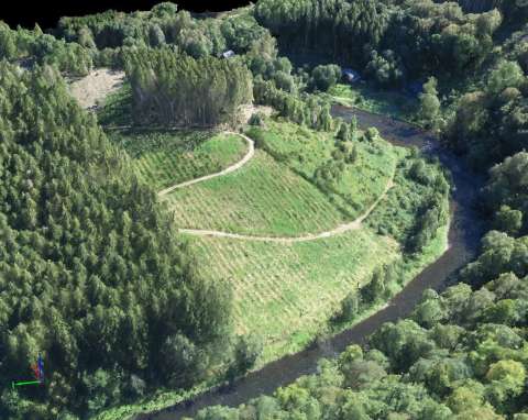
Acquired images, either aerial or terrestrial, can be combined with height information to create a realistic 3-dimensional view.
The images are processed to create photorealistic 3D models from either drone, aerial or terrestrial images. Fly-through videos and full-textured-mesh models can be created to showcase your area of interest on the web and social media.
The created 3D mesh can be used for an enhanced visual experience (through either VR or AR), but can also serve as a source for 3-dimensional measurements, including volumetric measurements.
Feature extraction
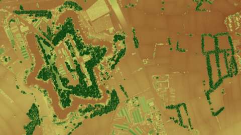
Based on a specific pattern or colour features can automatically be detected in images. This feature/object extraction benefits greatly from the availability of height information.
By integrating height models, the delineation of objects is greatly improved as the edge detection (object delineation) is not solely based on the colours in the image, but is supported by the height differences visible in the point cloud or digital elevation model.
An alternative methodology (feature recognition) can detect features based on their similarity in shape, texture, and variance with a set of available training data.
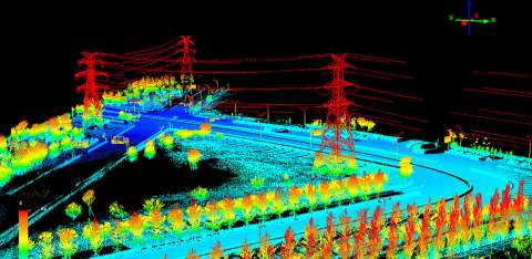
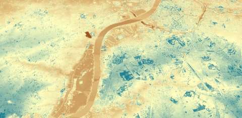
Point cloud analysis
There is a growing need of innovative methods for the treatment and analysis of point cloud data and for their classification, aimed ultimately to exploit in-depth the informative value of these surveys and representations.
An intelligent classification of point clouds can provide info on the amount of trees in the area, the area of sealed surface, free parking spaces in a parking lot, etc.
An advanced analysis of the point cloud can be performed on point clouds resulting from either drone images, aerial LiDAR scanning missions, or terrestrial scanners.
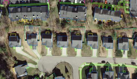
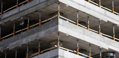
BIM (Building Information Model)
Building Information Modeling (BIM) is an intelligent 3D model-based process that equips architecture, engineering, and construction professionals with the insight and tools to more efficiently plan, design, construct, and manage buildings and infrastructure.
Points clouds can be used to quickly and inexpensively capture the surrounding environment in 3D format to serve as a a virtual site/building survey tool.
On projects constructed from BIM, the as-built point cloud models are often used to update the construction BIM models.
DSM and DTM extraction
Digital elevation models (DEMs) contain the elevation of a point on a surface above the mean sea level. A digital Surface Model (DSM) represents the ground elevations above the sea level with all other features such as trees, buildings, hills, etc., present on it, while a DTM is a raster image of the bare earth in which the pixel values represent the ground elevation above sea level.
DSM's can be accurately generated based on aerial or drone images using photogrammetric methods, or can easily be derived from LiDAR data. A terrain model can be derived from the created DSM through intelligent filtering.