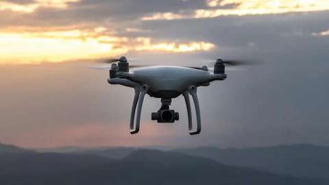
In comparison to standard aerial data acquisition, data collection with drones/UAVs is considerably less expensive, moreover data collected by drones has a very short processing chain whereby the time span between flight and result delivery is shortened to a few weeks.
We specialise in adding value to drone data
We specialise in adding value to drone data, others often stop at the creation of an orthomosaic, we tend to go further and use the drone data as a data source to give the customer what they want. Not just a basic image, we take the next step. Using the drone acquired data to perform a detailed 2D and 3D analysis.
BitsOfData has partnerships with multiple drone operators, enabling us to select the most appropriate system for the task at hand.
We process your data
While just about anyone can capture aerial images with the use of a drone, not just anyone can process those images.
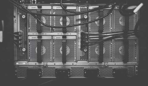
Processing data of any kind is a delicate ordeal, and if you don’t know what you’re doing, your processed data can turn out severely flawed. There are a number of existing software on the market that can do a lot of the work for you, but none of them are perfect. While the use of this software is wise, it’s important that the people operating them know the difference between correctly processing data, and incorrectly processing data. Quality control is key.
- You want to focus on flying your drone?
- You are unfamiliar with the processing needed to turn your images into correct data?
- Your hardware can't cope with the high demands of the processing software?
BitsOfdata focuses on the processing and analysis of drone images, we can help you process your data!
Applications areas
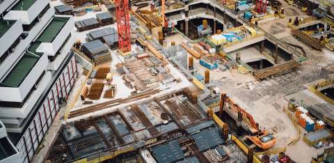
Construction monitoring
Videos and photos from drones are perfect for monitoring construction site progress. The low-altitude, high resolution perspective shots from drones provide a great overview of the site.
Weekly pictures and video can be taken from the exact same location (position, altitude, angle). This provides a "time lapse" view, making it possible to visualize progress. We can also create accurate 3-dimensional models of the site for specific analysis such as stockpile volume measurements.
In a next step these models can be converted into CAD-drawings, enabling a comparison between original plans and the as-built situation.
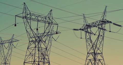
Inspections
There are several methods for inspection, like the cherry picker, service platform, hydraulic crane or rope descent. The problem with these methods is that they involve heavy equipment or climbing, which is time consuming, costly and very dangerous.
A safe and efficient solution to these issues is the employment of unmanned aircraft systems (UAS) to perform inspection. UAS do not require heavy equipment and therefore lower the inspection time as well as the down time of the turbine substantially. The advantage of UAS is that they can provide several methods of inspection including high-resolution images, full HD recordings and even multispectral thermal imaging at lower costs than traditional methods.
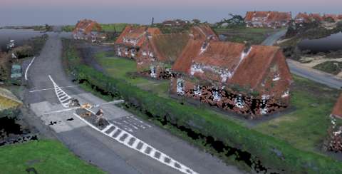
3D mapping
Looking for more than just a pretty picture? If you need accurate geospatial information, we can help!
We can acquire imagery with sufficient overlap to be able to produce orthorectified image mosaics using sophisticated photogrammetry software. The image mosaics are essentially "photo maps", where distortion is removed and accurate measurements can be made from the imagery. Additionally, we can provide highly accurate digital elevation models (surface and bare ground), contours, volume measurements, 3D models, and more...
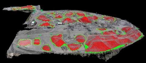
Volumetric measurement
In the mining sector, construction planning and even archaeology, accurate 3D mosaics of the environment benefits the efficient collection of resources without any shortages or surpluses.
Due to the nature of many raw materials like coal, logs and iron ore, it is very challenging to quantify the exact amount of resources present in a specified area. This is important for various reasons, like knowing how much has been displaced, how much can be excavated or how much can be filled. Previously, measurements had to be taken from the ground with a laser scanner or from above with a helicopter or plane. These methods are known to be inaccurate, time consuming and expensive.