Rheticus® Displacement
Rheticus® Displacement is an automatic cloud-based geoinformation service designed to deliver fresh and accurate satellite-based data and information for the monitoring of ground surface movements
Rheticus® Displacement is an automatic cloud-based geoinformation service designed to deliver fresh and accurate satellite-based data and information for the monitoring of ground surface movements
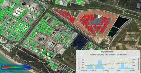
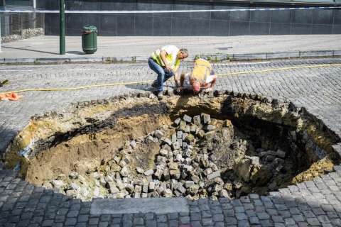
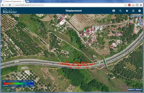
The Rheticus Displacement geoinformation service offers monthly monitoring of millimetric displacements of the ground surface, landslide areas, the stability of infrastructures, and subsidence due to groundwater withdrawal/entry or from the excavation of mines and tunnels. The service also provides information on anthropic changes and infrastructural dynamics over the area where the infrastructure is established.
Rheticus Displacement provides a yearly historical analysis with monthly updates. The mapping activity is made through the monitoring of points on the ground with high stability called Persistent Scatterers (PS). The PS is produced through the processing of the European Copernicus Sentinel-1 satellite images.
Already used by main European infrastructures and transportation engineering companies, the service is targeted to: Infrastructures and works managers and builders; Public Administration; Planners & professionals in the territory.
The service provides continuous monitoring of areas subject to:Who is it for?
Millimetric measurements of ground displacement also record movement velocity and rate of acceleration for accurate diagnosis of problem areas.
The high revisit time of the Sentinel-2 satellites (ca. 1 week) enables a detailed trend analysis, the combination with archived satellite data enables a view on historical deformations.
Combined archived and current satellite data identify trends in ground displacement. Updated information is provided on a monthly or quarterly basis, depending on the location of your network.
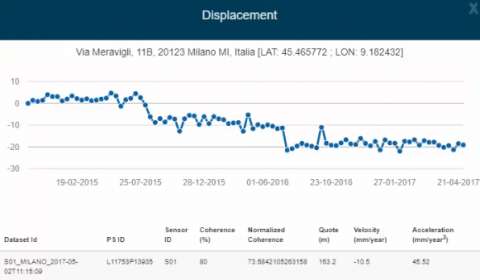
Using European Copernicus Sentinel-1 data and persistent scatterers techniques, data acquisition is independent of weather conditions. Monitoring is still feasible during clouded and wet periods.
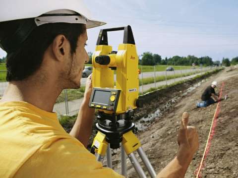
The service is complementary to traditional survey methods, providing a long-term solution to ground instability monitoring.
By combining the relative measurements of the Rheticus service with absolute measurements carried out with traditional ground stations, enriched information becomes available.